The Unique Maps Co.
Old Map of Juneau, Alaska by USGS, 1949 – Mendenhall Glacier, Douglas Island & Tongass National Forest
Old Map of Juneau, Alaska by USGS, 1949 – Mendenhall Glacier, Douglas Island & Tongass National Forest
Couldn't load pickup availability
“Juneau B-2,” produced by the U.S. Geological Survey in 1949, presents the capital district of southeastern Alaska at the authoritative 1:62,500 scale, a close and practical view of one of North America’s most dramatic coastal landscapes. Centered on Juneau—then the capital of the Territory of Alaska—the map captures a city pressed between saltwater and steep mountains, with Douglas Island across Gastineau Channel and the forested mainland rising abruptly behind. The title itself, terse and systematic, belongs to the USGS quadrangle tradition: a grid of scientific observation that transformed remote terrain into legible national geography. In this sheet, civic space, mining country, glacial valleys, and maritime passages are arranged with the precision and restraint that made federal topographic mapping indispensable.
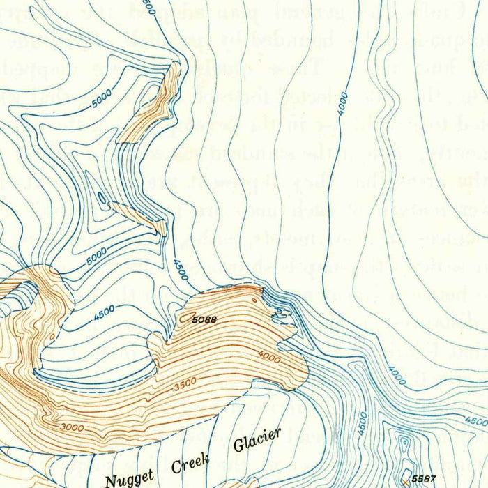
The map’s topographic language is especially compelling: tightly drawn contour lines reveal the sudden verticality of the Juneau landscape, where coastal settlement gives way almost immediately to ridges, basins, and alpine slopes. Mount Roberts and Mount Juneau dominate the terrain east of the town, their elevations rendered through the rhythmic brown linework characteristic of USGS mapping. Waterways and shorelines, including Gastineau Channel, Auke Bay, Lemon Creek, Fish Creek, and Twin Lakes, provide a blue counterpoint to the rugged relief. The distinctive color palette clarifies the relationships between forest, water, settlement, and rock, allowing the eye to move from harbor to glacier, from road to mountain pass, and from inhabited shore to wilderness interior.
Among the most evocative features is Mendenhall Glacier, a landmark of the Juneau Icefield and one of the region’s defining natural phenomena. Its presence anchors the northern portion of the mapped landscape, suggesting both immense age and constant movement. Nearby Auke Lake and Auke Bay mark a gentler coastal environment, while Eagle Beach and Deep Cove evoke the intricate shorelines of the Inside Passage. The surrounding Tongass National Forest frames the whole composition, emphasizing Juneau’s position within a vast temperate rainforest ecosystem. Valleys such as Lemon Creek and basins such as Silver Bow Basin show how ice, water, and elevation shaped the routes by which people moved through and used this formidable terrain.
The human geography of the map is equally rich. Juneau and Douglas face one another across Gastineau Channel, a narrow maritime corridor that shaped transportation, settlement, and industry. Silver Bow Basin recalls the gold-mining history that brought dramatic growth to the area after the discoveries of the 1880s, while the steep terrain around Mount Roberts and Mount Juneau hints at the difficult relationship between mineral ambition and alpine geography. Roads and trails trace modest but vital lines through the landscape, linking waterfront districts, creek valleys, lakes, and outlying settlements. In 1949, before Alaska statehood, this was a map of a territorial capital poised between frontier infrastructure and modern administrative importance.
As a historical document, “Juneau B-2” preserves a mid-twentieth-century understanding of a place that has since undergone substantial change. Urban expansion, road development, shifting shore uses, and environmental transformation—particularly around glacial margins—make the map a fascinating record of an earlier Juneau. Yet its power lies not only in comparison with the present, but in its elegant synthesis of science and scenery. The USGS rendered a landscape of extraordinary complexity with disciplined clarity: mountains, valleys, waterways, forest, settlement, and ice all organized into a coherent visual system. For admirers of Alaska, topography, and federal cartographic craft, this map offers a striking portrait of the capital region at a pivotal historical moment.
Cities, towns and places on this map
- Juneau
- Douglas Island
- Tongass National Forest
- Mendenhall Glacier
- Auke Bay
- Silver Bow Basin
- Lemon Creek
- Fish Creek
- Capital City
- Gastineau Channel
- Twin Lakes
- Ketchikan Creek
- Mount Roberts
- Mount Juneau
- Deep Cove
- Eagle Beach
- Sheep Mountain
- Green Lake
- Douglas
- Auke Lake
- John Muir Elementary School
- Trails and roads
Historical context & cartographic details
- Produced by the U.S. Geological Survey (USGS)
- Created in 1949
- Historical topographical map at 1:62,500 scale
- Illustrates Juneau, Alaska, and the surrounding area
- Features contour lines to indicate elevation changes
- Uses a distinctive color palette to represent terrain features
- Shows rugged Alaskan terrain, including mountains, valleys, and water bodies
- Reflects the geographic understanding of the region as of 1949
- Documents the area before later urban expansion and environmental changes
Looking for a particular place? Review the detailed images to confirm that the town, landmark or feature you have in mind appears on the map. If you are unsure, ask our workshop to check before you order.
Detailed maps are especially rewarding at larger sizes, where names, boundaries and decorative features have more room to be appreciated. Use the close-up preview and size guide to choose the right scale for your wall.
This map looks amazing at sizes all the way up to 50in (125cm). If you are looking for a larger map, please get in touch.
The model in the listing images is holding the 16x20in (40x50cm) version of this map.
Where personalisation is available, you can add a short title or dedication, mark one meaningful place, or request one considered visual detail. See personalised map examples.
Every piece is printed to museum-grade archival standards using fade-resistant pigment inks on acid-free matte paper. Choose an unframed map print, framed map or canvas using the finish options above. Framed maps use crystal-clear optical acrylic and arrive ready to hang.
With its rich detail and strong sense of place, this map makes a considered gift for a new home, anniversary, retirement or anyone with a personal connection to the area shown. Still deciding? Explore our collection of rare old and vintage maps to discover another place, period or style.
Share