The Unique Maps Co.
Old Map of Dover, Delaware by USGS, 1926 – Camden, Wyoming & Delaware Bay
Old Map of Dover, Delaware by USGS, 1926 – Camden, Wyoming & Delaware Bay
Couldn't load pickup availability
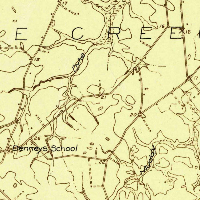
The United States Geological Survey’s 1926 map titled “Wyoming” presents central Delaware with the quiet authority of early twentieth-century federal cartography. Marked “Advance,” it captures a landscape in the process of being measured, systematized, and made legible for public use, infrastructure planning, agriculture, and travel. Though named for the town of Wyoming, the sheet embraces a broader region around Dover, Delaware’s capital, placing that historic city within its surrounding network of villages, roads, railways, streams, and lowland terrain. Its restrained design is characteristic of USGS topographic work: practical, precise, and deeply informative, with contour lines revealing subtle shifts in elevation across a landscape often perceived as flat, but here shown as textured and dynamic.
Dover forms the historical and geographic anchor of the map, a city whose significance reaches back to colonial governance, the American Revolution, and Delaware’s early statehood. Around it appear Camden and Wyoming, closely linked communities south of the capital, along with Felton, Hartly, Little Creek, Leipsic, and Smyrna, each situated within the rural matrix of roads, farms, waterways, and rail connections that defined the region in the 1920s. The map records a Delaware before later suburban expansion transformed much of the corridor around Dover. In this sense, it is not only a topographical document, but a portrait of settlement patterns, transportation routes, and civic geography at a moment when the automobile age was beginning to reshape the Mid-Atlantic landscape.
The cartography is elegantly functional, relying on the visual language that made USGS maps indispensable: contour lines, hydrographic detail, transportation symbols, and carefully placed place names. Roads and railways trace the arteries of movement through Kent County and beyond, while the measured contours disclose shallow rises, drainage patterns, and the relationship between settlement and terrain. The Murderkill River and St. Jones River are especially important features, their courses helping to explain the placement of towns, agricultural lands, and routes toward Delaware Bay. Streams, marshy lowlands, and smaller water bodies lend the map a subtle environmental richness, reminding the viewer that this region’s history has always been shaped by water as much as by roads.
To the east, the presence of Delaware Bay gives the map a broader coastal significance. Towns such as Little Creek and Leipsic evoke the long maritime and tidal history of the state, where fishing, shipping, marshland ecology, and inland agriculture intersected. The bay and its tributaries linked local communities to wider Atlantic trade and migration networks, while also imposing the practical realities of wetlands, drainage, and seasonal flooding. The map’s depiction of rivers and low-lying terrain offers insight into how early twentieth-century surveyors understood this coastal plain: not as an empty expanse, but as a finely grained system of waterways, routes, and cultivated ground. Its topographic detail rewards close study, revealing the quiet complexity of central Delaware.
Created by the United States Geological Survey, this map belongs to a distinguished tradition of American scientific mapping that combined field observation, standardized symbols, and national ambition. By the 1920s, the USGS had become the authoritative mapper of the nation’s physical geography, producing sheets that served engineers, educators, planners, travelers, and local officials alike. “Wyoming” reflects that mission with clarity and discipline, preserving a view of Delaware at a pivotal moment between older rural patterns and modern infrastructural growth. Compared with present-day maps, it highlights changes in land use, road expansion, urban development around Dover, and the evolving relationship between town and countryside. It is a refined historical record of place, measurement, and transformation.
Cities, towns and places on this map
- Dover
- Wyoming
- Camden
- Felton
- Hartly
- Little Creek
- Leipsic
- Smyrna
- Mendenhall
- Blackbird
- Murderkill River
- St. Jones River
- Delaware Bay
- Various roads and railways indicated by lines
- Streams and smaller water bodies
- Contours indicating elevation changes
- Parks and natural reserves marked with shading or distinct marks
Historical context & cartographic details
- Produced by the United States Geological Survey in 1926.
- Labeled “Advance,” indicating an early or preliminary issue of the map.
- Created by the United States Geological Survey, known for detailed topographical mapping based on comprehensive geographic data collection.
- Uses a simple, functional design typical of early 20th-century USGS topographic maps.
- Shows historical topography and landforms, offering insight into the area’s hills, valleys, and terrain.
- Reflects the geographic understanding of the region during the 1920s.
- Useful for comparing past and present patterns of urban development, land use, and infrastructure expansion.
Looking for a particular place? Review the detailed images to confirm that the town, landmark or feature you have in mind appears on the map. If you are unsure, ask our workshop to check before you order.
Detailed maps are especially rewarding at larger sizes, where names, boundaries and decorative features have more room to be appreciated. Use the close-up preview and size guide to choose the right scale for your wall.
This map looks amazing at sizes all the way up to 50in (125cm). If you are looking for a larger map, please get in touch.
The model in the listing images is holding the 16x20in (40x50cm) version of this map.
Where personalisation is available, you can add a short title or dedication, mark one meaningful place, or request one considered visual detail. See personalised map examples.
Every piece is printed to museum-grade archival standards using fade-resistant pigment inks on acid-free matte paper. Choose an unframed map print, framed map or canvas using the finish options above. Framed maps use crystal-clear optical acrylic and arrive ready to hang.
With its rich detail and strong sense of place, this map makes a considered gift for a new home, anniversary, retirement or anyone with a personal connection to the area shown. Still deciding? Explore our collection of rare old and vintage maps to discover another place, period or style.
Share