The Unique Maps Co.
Map of Seldovia C-5 NE Alaska by USGS, 1987 – Homer, Kachemak Bay, Kenai Peninsula
Map of Seldovia C-5 NE Alaska by USGS, 1987 – Homer, Kachemak Bay, Kenai Peninsula
Couldn't load pickup availability
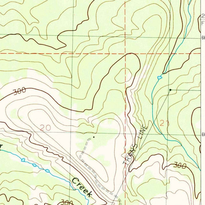
Seldovia C-5 NE is the original title of this finely detailed USGS topographical sheet, published in 1987 with an imprint of the same year. Centered on Homer and the surrounding reaches of Alaska’s Kenai Peninsula, the map distills the rugged meeting of mountain, tundra, and sea at a crisp 1:25,000 scale. Its “Provisional” designation, printed prominently, signals a work issued to meet pressing informational needs while some datasets awaited fuller verification—an honest cartographic snapshot taken mid-revision. Readers will find the classic USGS symbology at its most legible: calibrated contour lines wrapping the coastal bluffs and uplands, color treatments separating elevations with quiet precision, and a confident delineation of shorelines and wetlands where Kachemak Bay’s tides sculpt the landscape.
The United States Geological Survey stands behind this sheet, bringing to it the agency’s century-deep authority in mapping America’s terrains and waters. By the late 1980s, USGS cartographers were synthesizing photogrammetric analysis, field checks, and modern printing to deliver maps that could guide scientists, engineers, and outdoorspeople with equal reliability. Here that expertise shows in the choreography of line and hue: contour intervals that articulate relief with scientific clarity; hydrographic and land-use layers that interlock without clutter; and road, grid, and boundary information tuned to real-world navigation. The “provisional” note does not diminish the map’s value; rather, it documents an intentional, iterative approach to accuracy in a vast and rapidly studied Alaskan domain.
Geography dominates with the sweep of Kachemak Bay, its indented shoreline scalloped by coves, tidal mudflats, and saltmarsh sloughs. The Homer Spit thrusts into the bay like a cartographic exclamation of glacial legacy and longshore drift, while inland the bluffs step upward in terraces that the contours render with sculptural finesse. Numerous creeks braid off the uplands to meet the tidelands, and low wetlands and ponds stud the forelands behind the beach ridges. Subtle color gradients shade the foothills that lean toward the Kenai Mountains, revealing the pull of past ice across moraine-studded ground. Together, water and relief read as a living system—an estuarine threshold that channels weather, wildlife, and human movement along its narrow corridors and high, view-rich ridgelines.
Human imprints are drawn with equal care. Homer’s townsite resolves into a crisp framework of streets and services, its coastal infrastructure arrayed along the Spit and shoreline. The Sterling Highway’s approach anchors the terrestrial connection to the rest of the peninsula, while secondary roads and spurs trace homesteads, farms, and wooded parcels climbing the hillside. Trails and unimproved tracks stitch the backcountry to the bay, marking routes used for forestry, recreation, and access to remote homesites. Utilities, landmarks, and selected facilities appear in the clean USGS vernacular, situating everyday life within a landscape that still dictates terms—steep grades, marshy bottoms, seasonal watercourses—all made legible through the interlock of linework, labels, and tone.
As a product of a high-water mark in USGS cartography, Seldovia C-5 NE speaks to a period when detailed mapping underpinned land-use planning, ecological research, fisheries management, and the blossoming of outdoor recreation in coastal Alaska. Scientists mined sheets like this for habitat mosaics; planners weighed roads against slope and drainage; hikers and boaters navigated with confidence between bluff-top viewpoints and tideline landings. Aesthetically, the sheet exemplifies the agency’s late-20th-century palette: restrained yet luminous color, disciplined typography, and contours that convey form almost tactilely. Historically, the provisional tag captures a frontier of knowledge just before digital workflows transformed revision cycles—preserving, in elegant print, the working intelligence of place at a crucial moment in Alaska’s modern story.
Cities, towns and places on this map
- Homer, Alaska
- Surrounding Kenai Peninsula region
Notable Features & Landmarks
- Contour Lines: Clearly represented, indicating elevation changes and terrain relief
- Major Water Bodies: Kachemak Bay and adjoining rivers are depicted
- Settlements: The town of Homer and various smaller locations are marked
- Roads and Trails: Various transportation routes are visible, highlighting accessibility in the region
- Provisional Notation: Indicates that the map was produced with some uncertainty or lack of definitive data at the time
Historical and design context
- Produced by the US Geological Survey
- Notable for its role in producing authoritative maps of the United States, utilizing scientific methods to study and document topographical and geological features.
- Historical 1:25,000 topographical map showing Homer, Alaska, and surrounding areas
- Dated 1987, carrying a 1987 imprint
- Noted as a provisional map
- Utilizes color to differentiate between various types of terrain and elevations
- Contour lines are prominently displayed, offering a clear representation of the landscape
- The map is part of a significant era of detailed cartography through the USGS, enhancing land use planning, ecological studies, and recreational activities.
- The use of subtle color gradients for elevation levels provides an aesthetically pleasing and functionally effective method of conveying the topography, characteristic of USGS maps from this period.
Looking for a particular place? Review the detailed images to confirm that the town, landmark or feature you have in mind appears on the map. If you are unsure, ask our workshop to check before you order.
Detailed maps are especially rewarding at larger sizes, where names, boundaries and decorative features have more room to be appreciated. Use the close-up preview and size guide to choose the right scale for your wall.
This map looks amazing at sizes all the way up to 50in (125cm). If you are looking for a larger map, please get in touch.
The model in the listing images is holding the 16x20in (40x50cm) version of this map.
Where personalisation is available, you can add a short title or dedication, mark one meaningful place, or request one considered visual detail. See personalised map examples.
Every piece is printed to museum-grade archival standards using fade-resistant pigment inks on acid-free matte paper. Choose an unframed map print, framed map or canvas using the finish options above. Framed maps use crystal-clear optical acrylic and arrive ready to hang.
With its rich detail and strong sense of place, this map makes a considered gift for a new home, anniversary, retirement or anyone with a personal connection to the area shown. Still deciding? Explore our collection of rare old and vintage maps to discover another place, period or style.
Share