The Unique Maps Co.
Map of Homer, Alaska by USGS, 1987 – Kachemak Bay, Seldovia & Kenai Peninsula
Map of Homer, Alaska by USGS, 1987 – Kachemak Bay, Seldovia & Kenai Peninsula
Couldn't load pickup availability
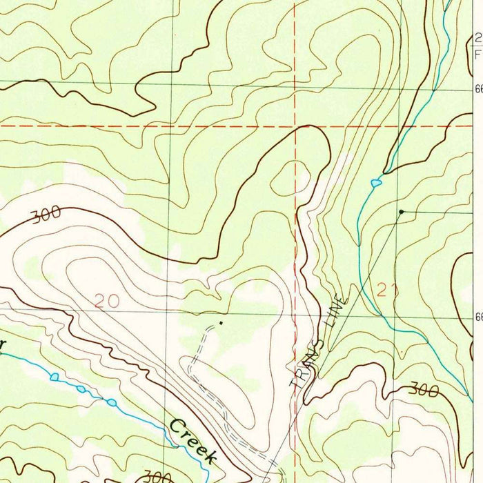
Published in 1987 by the United States Geological Survey, “Seldovia C-5 NE” is a provisional 1:25,000 topographical map capturing a dramatic corner of Alaska’s southern Kenai Peninsula. At this detailed scale, the map brings into focus the meeting of rugged uplands, indented coastlines, and the cold waters of Kachemak Bay. Its provisional status is itself evocative: this was a working portrait of a dynamic landscape, issued to provide timely geographic intelligence in a region where settlement, access, and environmental understanding were still being refined. The classic USGS language of contour lines, hydrographic blue, and carefully differentiated landforms gives the map both scientific precision and visual elegance, translating Alaska’s steep terrain into a disciplined and readable cartographic composition.
The US Geological Survey has long been the authoritative cartographer of American landscapes, and this map reflects the agency’s distinctive blend of field science, public utility, and understated design. Founded in the aftermath of the great western surveys of the nineteenth century, the USGS became indispensable for mapping terrain, mineral resources, water systems, and infrastructure across the United States. In Alaska, where distances are vast and landforms often challenging, its work carried particular importance. “Seldovia C-5 NE” belongs to that tradition: a map intended for explorers, planners, scientists, pilots, land managers, and residents alike. Its contours do more than measure elevation; they reveal the physical logic of the region—where ridges divide watersheds, where valleys invite passage, and where coastlines govern movement.
The map’s geography is anchored by Homer, one of Alaska’s best-known coastal communities and a gateway to the astonishing natural world of Kachemak Bay. Homer’s position on the southern Kenai Peninsula has made it a center for fishing, marine travel, art, and wilderness tourism, and the map situates the city within the broader topographic setting that gives it such character. Roads and trails thread outward through a landscape of hills, ridges, lakes, and stream courses, while the shoreline traces the complex edge between inhabited ground and tidal water. Nearby names such as Seldovia, Port Graham, and Redoubt Bay evoke older networks of coastal settlement and navigation, where boat routes and sheltered harbors were often as significant as overland roads.
Kachemak Bay is one of the map’s defining features, both visually and geographically. Its waters cut deeply into the Kenai Peninsula, creating a sheltered marine environment framed by steep land and broken shore. Around it, contour lines tighten and loosen in rhythmic patterns, suggesting abrupt climbs, rolling uplands, and valley floors shaped by erosion and glacial history. The map’s smaller lakes and rivers are not incidental details; they articulate the drainage pattern of a wet, mountainous coastal region. In Alaska, water is infrastructure, habitat, boundary, and route. The cartography makes this evident, showing how streams descend from upland basins toward the bay and how coastal form dictates settlement, travel, and the use of the surrounding land.
As a late-twentieth-century document, the 1987 “Seldovia C-5 NE” also offers a historical snapshot of development and land use near Homer and Kachemak Bay. The presence of roads, trails, parklands, named peaks, and coastal settlements records a moment when the region’s modern identity was being shaped by fishing, recreation, conservation, and expanding access. Kachemak Bay State Park, with its celebrated mix of mountains, forest, shoreline, and marine habitat, underscores the area’s environmental significance. The map captures not only a landscape of great natural drama, but a cultural geography of Alaska at the edge of wilderness and community. Its provisional lines preserve the practical intelligence of their time while inviting contemplation of a place still defined by weather, water, and terrain.
Cities, towns and places on this map
- Homer
- Kachemak Bay
- Seldovia
- Port Graham
- Redoubt Bay
- Kachemak Bay State Park
- Smaller lakes and rivers
- Roads and trails leading to and from Homer
- Hills and ridges
- Coastal lines along the southern Kenai Peninsula
- Named mountains and peaks in the vicinity of the map
Historical context & cartographic details
- Produced by the US Geological Survey
- Historical 1:25,000 topographical map dated and published in 1987
- Marked as provisional
- Features a classic topographic style with contour lines showing elevation changes
- Uses color coding to differentiate landforms and water bodies
- Shows rugged Alaskan terrain, including mountains, valleys, and coastal features
- Reflects late 20th-century land use and development in the area
- Provides insight into the geographical evolution of the Homer and Kachemak Bay region
Looking for a particular place? Review the detailed images to confirm that the town, landmark or feature you have in mind appears on the map. If you are unsure, ask our workshop to check before you order.
Detailed maps are especially rewarding at larger sizes, where names, boundaries and decorative features have more room to be appreciated. Use the close-up preview and size guide to choose the right scale for your wall.
This map looks amazing at sizes all the way up to 50in (125cm). If you are looking for a larger map, please get in touch.
The model in the listing images is holding the 16x20in (40x50cm) version of this map.
Where personalisation is available, you can add a short title or dedication, mark one meaningful place, or request one considered visual detail. See personalised map examples.
Every piece is printed to museum-grade archival standards using fade-resistant pigment inks on acid-free matte paper. Choose an unframed map print, framed map or canvas using the finish options above. Framed maps use crystal-clear optical acrylic and arrive ready to hang.
With its rich detail and strong sense of place, this map makes a considered gift for a new home, anniversary, retirement or anyone with a personal connection to the area shown. Still deciding? Explore our collection of rare old and vintage maps to discover another place, period or style.
Share